
The region of Pindos is an amazing place and full of pleasant surprises. Having been in this region several times, I have also decided to do a small hike between two beautiful picturesque villages, Kallarites and Syrrako.
This hike was done just few hours after the completion of the Lakmos mountain crossing and after a very peaceful night I have stayed on the Alpine lake of Verliga.

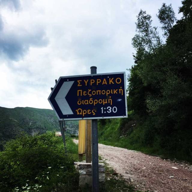
The route starts from the central square of Kallarites village and it is very well signed with many signs and very clear path towards Syrrako. Actually, from what I could understand, there has been recent maintenance on this route.
The entire route is about 4.5 kilometres one way (so about 9 kilometres round trip) and relatively easy hike. Actually, in terms of trail, is a very easy and straight forward trail, though, there are a lot of steps that bring you down from Kallarites to the level of the river and then a steep ascent towards the village of Syrrako.


Kallarites Village
Kalarrytes is a mountain village located on the western slopes of the geotectonic zone of the Pindos mountain range of the Prefecture of Ioannina in Epirus. It is located at the southeast end of the prefecture, 56 km south-east of Ioannina. The village flourished particularly in the 18th century. (woven, silk from Thessaly, raw animal skins, etc.) and the development of handicraft (works in silver and gold); during this period, many Kalarrytes’ residents kept merchant houses in many European centers. It is administered administratively in the Municipality of Northern Tzoumerka.
Location
Kalarrytes are geographically located in the Tzoumerka area. The main element of the area is the mountainous volumes surrounding the community, namely the Early (2285m) and the Tzoumerka (2429m). They are built on the edge of a steep ravine that leads to the Kalarrytiko River, at an altitude of 1200 m. Opposite to the southwest of the village is the hill called Pouliana. If the look turns south, it will see the mountains of Tzoumerka up to the village of Pramanta.
The site north and above the community is called Baros (2285 m). It is the area with the plateaus and the mountain pastures that connect Thessaly to Epirus. In the northwest of Kalarrytes is Syrrako, which in a straight line thinks it is very close, while the two settlements are separated by the steep ravine of Kalarrytikos river.
Climate
The climate of the area is characterized by the cold to severe and prolonged winter, short spring and hot, summer-rich, with a protracted autumn.The characteristic of Kalarrytes is their dry, moisture-free, climate.
The special climate of the region favors the growth of rich flora and fauna.The northeast community is surrounded by large, herbaceous and bushy vegetation, the so-called “grassy grasslands,” known in all pastures.


Syrrako Village
Syrrako (Greek: Συρράκο, between 1940 and 2002: Σιράκο – Sirako) is a village and a former community in the Ioannina regional unit, Epirus, Greece. Since the 2011 local government reform it is part of the municipality North Tzoumerka, of which it is a municipal unit. The municipal unit has an area of 29.307 km2. It has a predominantly Vlachs (Aromanians) population, and is located 52 km southeast of Ioannina at an altitude of 1200 m, on the mountain Peristeri. It is built on a steep slope in and retains its traditional buildings.
Location
Syrrako is built on the slopes of Mount Peristeri (Lakmos) in the Pindos, offering natural shelter and security.
Syrrako is separated from its twin village Kalarites by the deep ravine of the river Chroussias, a tributary of the Arachthos. Tradition says that the river’s name derives from Νeoptolemos’ son, Chroussios, who drowned there, not being aware of the fact that water rises fast during bad weather conditions.
History
Syrrako was inhabited before the 15th century (possibly in the 11th century) by Aromanians (Vlachs). Evidence for this includes the age of the plane trees in the village square. During the Ottoman period, after 1480, it was the capital of the self-governed federation of Malakasio, consisting of 42 villages and belonging to the Valide Sultan. Because of this it enjoyed a privileged treatment. During that time the village developed immensely. Firstly, the inhabitants were involved in cattle breeding and afterwards they developed trade, industrial production of wool textiles and cattle products.
The expanse of pasture land (nearly 750 kmª) enabled the inhabitants to raise the number of sheep and goats to thousands (50,000 and according to others 75,000) and bring the big quantity of their products, in connection with the Syrrakiotes’ trade genius, to the biggest trade centers in the Mediterranean and Black Sea (Italy, France, Spain, Odessa, Moscow, Bucharest, Belgrade, Constantinople and others).
Capes made in Syrrako were in great demand and it is said that even Napoleon’s army was supplied with a large number of them. The travellers Leake and François Pouqueville report in the years 1815 and 1818 that they found in Syrrako “a trade cycle comparable to the best European cities”. Furthermore, they mention the existence of significant libraries and the circulation of European newspapers, evidence that intellectual development co-existed with trade. Syrrako and Kalarrytes were the only villages in Epirus that took part in the first year of the 1821 Revolution with 720 families and 3,500 inhabitants. The Ottomans destroyed and burnt down the village, and the inhabitants abandoned it trying to save their lives (10 July 1821).
Only five buildings remained untouched, among them the church of the Panagia. The inhabitants returned in the year 1825 (according to others in 1827-28), rebuilt the village and between 1860-70 the village became again as imposing as in the previous years. A second revolution took place in 1854 which was of no consequence. The decline of the wool trade and its replacement by other fibers (1908–10) hurt the local economy and led to changes in production patterns. At that time 530 houses and nearly 5,000 inhabitants existed in the village.


Details of the Hike:
- Location: Lakmos (Peristeri) Mountain
- Starting Point: Kallarites Village
- Ending Point: Syrrako village
- Trail Signs: Well signed path
- Minimum Elevation: 980 m
- Maximum Elevation: 1.138 m.
- Total Distance: 4,5 km one way (9 km round trip)
- Difficulty: Easy
- When to Hike: Any time of the year
- Water Features: Plenty
Bellow you can see the route we have followed on 3D:


Pingback: Hiking in Tzoumerka (Athamanika) – Pramanta Refuge – Waterfall Kefalovriso – Olympus Mountaineering
Pingback: Hiking in Tzoumerka (Athamanika) – Skala Stamati – Katafidi – Olympus Mountaineering
Pingback: V Řecku zkuste mimo vznášející se kláštery i ty připlácnuté – Silver On The Road
Pingback: Hiking in Kouiassa Waterfall and Kipinas Monastery – Olympus Mountaineering
Pingback: A Family Adventure in Greece: Top 10 Hiking Routes for Nature-Loving Families – Olympus Mountaineering
Fantastic!!!
I finally visited Tzoumerka. It is so far from Belgrade, but my passion for stone villages of continental Greece finally prevailed. We spent 2 nights there (“Το σπιτι του δασκαλου”) and I did this trail twice in a single day 🙂 First at dawn, and then again with my children in the afternoon. The only thing I didnt like is the fence they made. It is so unnecessary to make hundreds of meters of stainless steel fence…Somebody took some money from EU support funds I guess…
Thanks a lot for a great historic lesson on this part of Epirus and Greece!
LikeLiked by 1 person
Thank you so much for sharing your exciting experience in Tzoumerka! It’s wonderful to hear that your passion for the villages of continental Greece led you to such a fantastic adventure.
I completely understand your sentiment about the unnecessary stainless steel fence, and it’s unfortunate that some funds might have been misused. Despite that, it’s heartwarming to know that you appreciated the historic lesson on this part of Epirus and Greece.
Thank you again for sharing your experience with such enthusiasm. Your passion for exploration and appreciation for the region’s history are truly inspiring. If you have any more stories or adventures to share, I’d love to hear them!
LikeLike